Worth stopping for
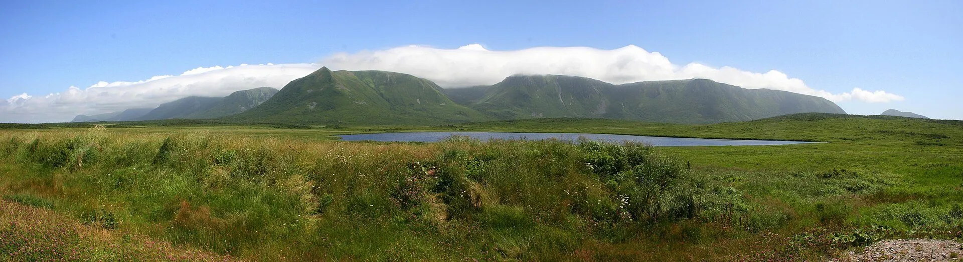
Wreckhouse
Getting here
To Wreckhouse from every airport and ferry, measured by road.
Sunrise and sunset at Wreckhouse, by month
| Month (the 15th) | Sunrise | Sunset |
|---|---|---|
| January | 8:11 am | 5:00 pm |
| February | 7:33 am | 5:48 pm |
| March | 7:41 am | 7:31 pm |
| April | 6:39 am | 8:15 pm |
| May | 5:49 am | 8:56 pm |
| June | 5:28 am | 9:26 pm |
| July | 5:43 am | 9:22 pm |
| August | 6:22 am | 8:41 pm |
| September | 7:03 am | 7:41 pm |
| October | 7:45 am | 6:40 pm |
| November | 7:32 am | 4:51 pm |
| December | 8:09 am | 4:35 pm |
Worked out for the 15th of each month at this spot, in local time. The weather line at the top has today's.
On the way to…
Port aux Basques → Codroy Valley →
A named place on the map, not a building, and the Trans-Canada runs straight through it. There is nothing to stop for, but this stretch makes its own weather. Check the conditions link in the seasons block before you drive it.
Stopping here adds about 0.2 km to that drive (40 km start to finish).
Port aux Basques → Cape St. George →
The most famous stretch of wind in Newfoundland. The Long Range funnels southeasterlies here hard enough that a man was once employed to decide whether trains could pass: Lauchie MacDougall, the human wind gauge. The Trans-Canada runs straight through it, and high-sided vehicles still get held when it blows. Check the forecast for your timing.
Stopping here adds about 0.2 km to that drive (222 km start to finish).
Port aux Basques → Corner Brook →
Stopping here adds about 0.2 km to that drive (222 km start to finish).
Port aux Basques → Marble Mountain →
Stopping here adds about 0.2 km to that drive (225 km start to finish).
Stopping here adds about 0.1 km to that drive (271 km start to finish).
Stopping here adds about 0.2 km to that drive (306 km start to finish).
Port aux Basques → Woody Point →
Stopping here adds about 0.2 km to that drive (332 km start to finish).
Port aux Basques → Gros Morne →
Stopping here adds about 0.2 km to that drive (337 km start to finish).
Stopping here adds about 0.2 km to that drive (383 km start to finish).
Port aux Basques → King's Point →
Stopping here adds about 0.2 km to that drive (399 km start to finish).
Port aux Basques → Baie Verte →
Stopping here adds about 0.2 km to that drive (426 km start to finish).
Port aux Basques → Long Island →
Stopping here adds about 0.2 km to that drive (438 km start to finish).
Stopping here adds about 0.2 km to that drive (441 km start to finish).
Stopping here adds about 0.2 km to that drive (475 km start to finish).
Port aux Basques → Grand Falls-Windsor →
Stopping here adds about 0.2 km to that drive (478 km start to finish).
Port aux Basques → Port au Choix →
Stopping here adds about 0.2 km to that drive (501 km start to finish).
Stopping here adds about 0.2 km to that drive (509 km start to finish).
Port aux Basques → St. Barbe ferry →
Stopping here adds about 0.2 km to that drive (564 km start to finish).
Port aux Basques → Leading Tickles →
Stopping here adds about 0.2 km to that drive (565 km start to finish).
Stopping here adds about 0.2 km to that drive (574 km start to finish).
Port aux Basques → Change Islands →
Stopping here adds about 0.2 km to that drive (609 km start to finish).
Port aux Basques → Fogo Island →
Stopping here adds about 0.2 km to that drive (609 km start to finish).
Port aux Basques → Roddickton →
Stopping here adds about 0.2 km to that drive (616 km start to finish).
Port aux Basques → St. Alban's →
Stopping here adds about 0.2 km to that drive (635 km start to finish).
Port aux Basques → Hermitage →
Stopping here adds about 0.2 km to that drive (676 km start to finish).
Port aux Basques → Harbour Breton →
Stopping here adds about 0.2 km to that drive (680 km start to finish).
Stopping here adds about 0.2 km to that drive (861 km start to finish).
Stopping here adds about 0.2 km to that drive (906 km start to finish).
Use another map app
Apple Maps · Google Maps · Organic Maps · OsmAnd (both work offline, no tracking) · WazeWhat the map knows
Mapped as place: village in OpenStreetMap.
While you're stopped here: J.T. Cheeseman Provincial Park (9.4 km away) · Starlite Trail trailhead (9.5 km away) · Cape Ray lighthouse (9.9 km away)
From OpenStreetMap, 2026-09-05 (last edited 2010-10-18). Listed, not recommended. How we measure
Access: step-free or not isn't recorded. Ask before you go.
Pin and figures from OpenStreetMap node/33952817 →