Worth stopping for
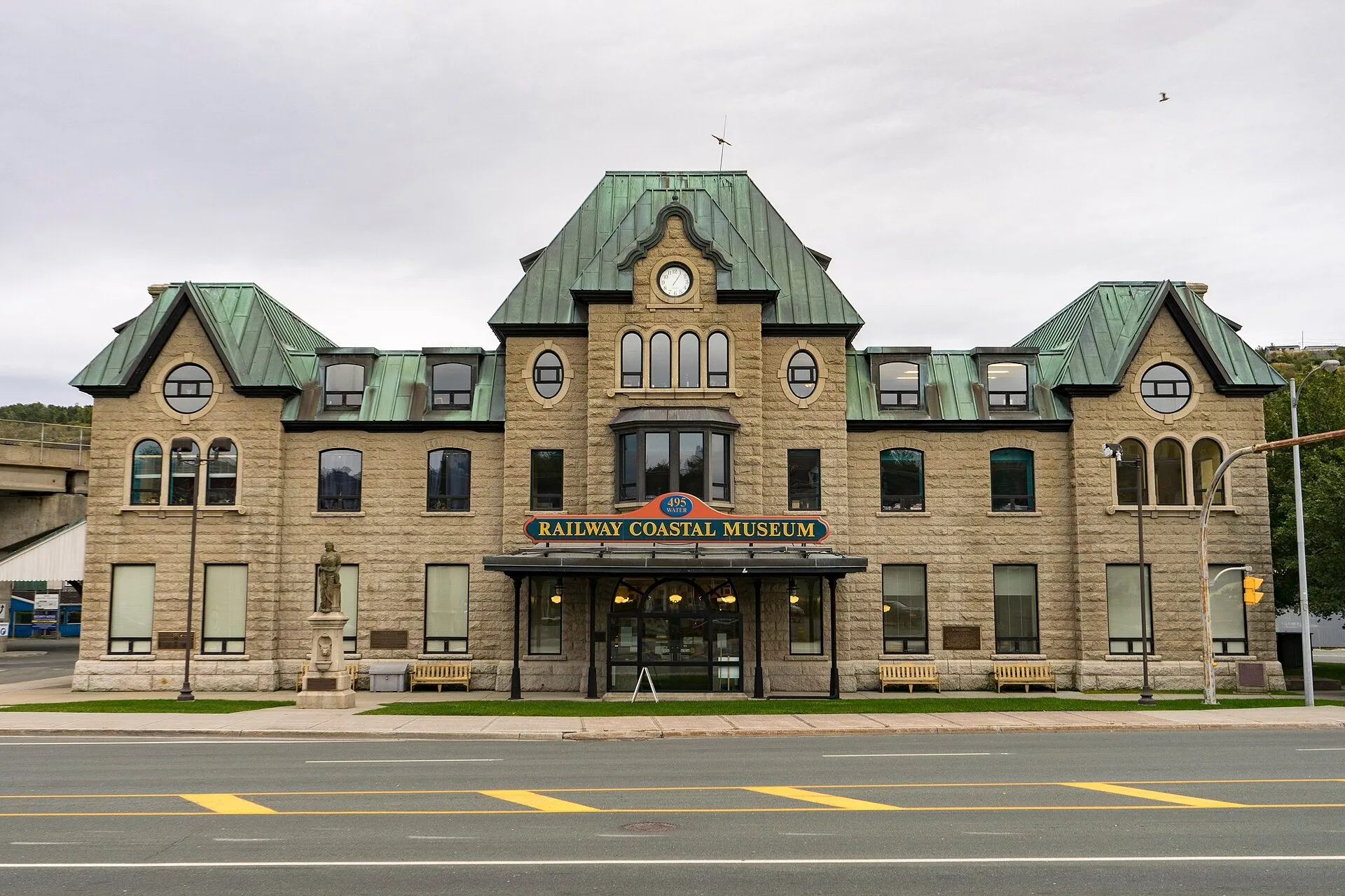
Railway Coastal Museum
Getting here
To Railway Coastal Museum from every airport and ferry, measured by road.
Sunrise and sunset at Railway Coastal Museum, by month
| Month (the 15th) | Sunrise | Sunset |
|---|---|---|
| January | 7:44 am | 4:35 pm |
| February | 7:07 am | 5:22 pm |
| March | 7:15 am | 7:05 pm |
| April | 6:12 am | 7:48 pm |
| May | 5:23 am | 8:29 pm |
| June | 5:02 am | 8:59 pm |
| July | 5:18 am | 8:55 pm |
| August | 5:56 am | 8:14 pm |
| September | 6:37 am | 7:14 pm |
| October | 7:18 am | 6:14 pm |
| November | 7:05 am | 4:25 pm |
| December | 7:42 am | 4:10 pm |
Worked out for the 15th of each month at this spot, in local time. The weather line at the top has today's.
On the way to…
The drive passes it at 495 Water Street: St. John's old railway station, now the Railway Coastal Museum, about the Newfoundland Railway and the coastal boats.
Stopping here adds about 0.3 km to that drive (24 km start to finish).
The city's former railway station at the west end of Water Street, now the museum of the same name. It stands where this route leaves downtown, so it costs almost no extra driving. Check its own site for hours and admission.
Stopping here adds about 1 km to that drive (46 km start to finish).
A museum on Water Street, in St. John's old railway station.
Stopping here adds about 1 km to that drive (86 km start to finish).
At 495 Water Street, St. John's old railway station, now the Railway Coastal Museum, about the Newfoundland Railway and the coastal boats.
Stopping here adds about 0.9 km to that drive (136 km start to finish).
Stopping here adds about 2.4 km to that drive (144 km start to finish).
St. John's former passenger railway station on Water Street, now a museum. The museum says it tells the story of the Newfoundland Railway and the coastal boats that eased the island's isolation. The building is the Riverhead Station, completed in 1903.
Stopping here adds about 1 km to that drive (144 km start to finish).
Stopping here adds about 0.9 km to that drive (338 km start to finish).
Stopping here adds about 2.4 km to that drive (346 km start to finish).
Stopping here adds about 0.9 km to that drive (641 km start to finish).
Stopping here adds about 2.4 km to that drive (649 km start to finish).
Port aux Basques → Signal Hill →
Stopping here adds about 0.9 km to that drive (907 km start to finish).
Port aux Basques → Cape Spear →
Stopping here adds about 2.4 km to that drive (916 km start to finish).
Use another map app
Apple Maps · Google Maps · Organic Maps · OsmAnd (both work offline, no tracking) · WazeWhat the map knows
While you're stopped here: Trans-Canada Trail Mile Zero Km (0 km away) · Trans-Canada Highway Zero Km (0.8 km away) · The Rooms (1.3 km away)
From OpenStreetMap, 2026-09-05. Listed, not recommended. How we measure
Access: step-free or not isn't recorded. Ask before you go.
Pin and figures from OpenStreetMap way/199699105 →