Worth stopping for
The Arches Provincial Park
Getting here
To The Arches Provincial Park from every airport and ferry, measured by road.
Sunrise and sunset at The Arches Provincial Park, by month
| Month (the 15th) | Sunrise | Sunset |
|---|---|---|
| January | 8:13 am | 4:45 pm |
| February | 7:32 am | 5:37 pm |
| March | 7:35 am | 7:24 pm |
| April | 6:28 am | 8:13 pm |
| May | 5:34 am | 8:58 pm |
| June | 5:09 am | 9:31 pm |
| July | 5:27 am | 9:25 pm |
| August | 6:09 am | 8:41 pm |
| September | 6:55 am | 7:36 pm |
| October | 7:41 am | 6:30 pm |
| November | 7:33 am | 4:37 pm |
| December | 8:13 am | 4:18 pm |
Worked out for the 15th of each month at this spot, in local time. The weather line at the top has today's.
On the way to…
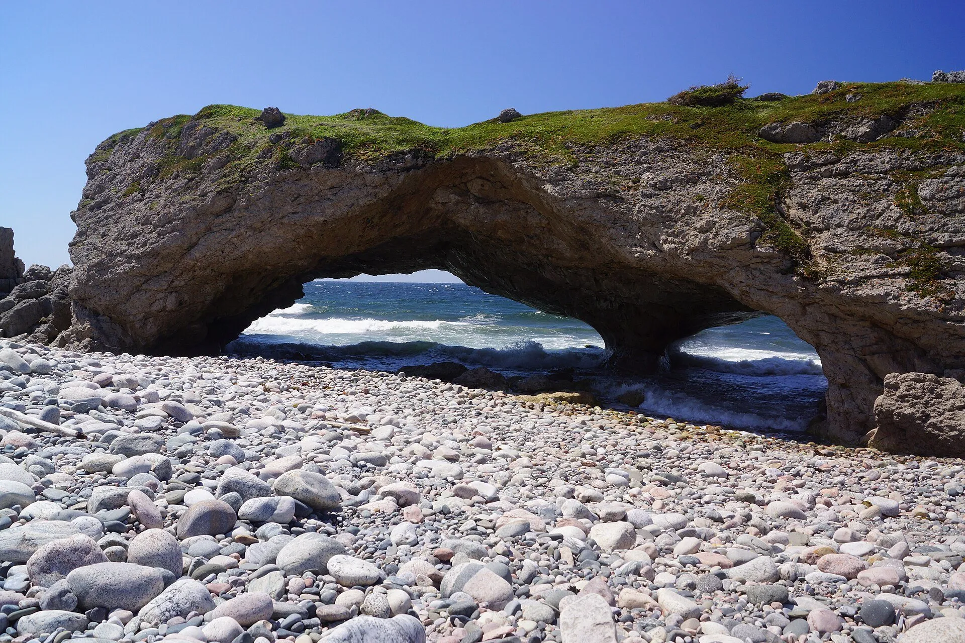
Sea-carved limestone arches in the surf right beside Route 430. The map holds the park as a reserve and names the rock formation. A ten-minute leg-stretch. ParksNL lists it as day use; keep back from the sea.
Stopping here adds about 0.4 km to that drive (236 km start to finish).
Stopping here adds about 0 km to that drive (352 km start to finish).
Port aux Basques → Port au Choix →
Stopping here adds about 0 km to that drive (501 km start to finish).
Stopping here adds about 0 km to that drive (539 km start to finish).
Port aux Basques → St. Barbe ferry →
Stopping here adds about 0 km to that drive (564 km start to finish).
Port aux Basques → Roddickton →
Stopping here adds about 0 km to that drive (616 km start to finish).
Stopping here adds about 0 km to that drive (655 km start to finish).
Stopping here adds about 0 km to that drive (826 km start to finish).
Stopping here adds about 0 km to that drive (871 km start to finish).
Stopping here adds about 0 km to that drive (942 km start to finish).
Stopping here adds about 0 km to that drive (986 km start to finish).
Use another map app
Apple Maps · Google Maps · Organic Maps · OsmAnd (both work offline, no tracking) · WazeWhat the map knows
Mapped as nature reserve in OpenStreetMap.
While you're stopped here: Shallow Bay beach (21.7 km away)
From OpenStreetMap, 2026-09-05 (last edited 2011-12-14). Listed, not recommended. How we measure
Access: step-free or not isn't recorded. Ask before you go.
Pin and figures from OpenStreetMap node/1546465380 →