Goose Bay Airport (YYR) → Point Amour Lighthouse
Goose Bay Airport (YYR) to Point Amour Lighthouse
The drive from every airport and ferry ↓
- Distance
- 600 km
- Drive time
- In your maps app ↗
Use another map app
Apple Maps · Google Maps · Organic Maps · OsmAnd (both work offline, no tracking) · Waze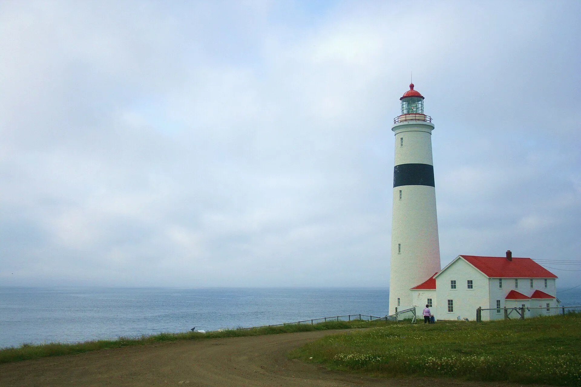

Faded lines are other drives from Goose Bay into this area: Forteau (605 km), Pinware (572 km), Red Bay (542 km). Each splits off where its line leaves this one.
Stop 1: Mary's HarbourDetour
Battle Harbour, the restored fishing village on Battle Island, gives Mary's Harbour as its address. How to get across is on their page.
Stopping here adds 5.4 km to the drive.
Directions →Show on map: Mary's Harbour ↑Other map apps
Apple · Google · Organic Maps · OsmAnd (both work offline, no tracking) · WazeStop 2: Red BayDetour
The mid-16th-century Basque whaling port on the Strait of Belle Isle, a Parks Canada national historic site and UNESCO World Heritage Site.
Stopping here adds 3.3 km to the drive.
Directions →Show on map: Red Bay ↑Other map apps
Apple · Google · Organic Maps · OsmAnd (both work offline, no tracking) · WazeStop 3: Pinware
A hamlet on Route 510 between Point Amour and Red Bay.
Directions →Show on map: Pinware ↑Other map apps
Apple · Google · Organic Maps · OsmAnd (both work offline, no tracking) · Waze
Scan with your phone to open this page there. Then tap Keep for offline before you lose signal.
Drive measured Oct 24, 2026, Goose Bay Airport (YYR) to Point Amour Lighthouse. Your maps app gives the time on the day. How we measure
600 km. Goose Bay airport to Point Amour Lighthouse on Routes 500 and 510.
Completed in 1857 to guide steamships down the Strait of Belle Isle, with 132 steps to the top. A Provincial Historic Site. The provincial historic sites’ page →
Sunrise and sunset at Point Amour Lighthouse, by month
| Month (the 15th) | Sunrise | Sunset |
|---|---|---|
| January | 8:16 am | 4:36 pm |
| February | 7:32 am | 5:31 pm |
| March | 7:32 am | 7:21 pm |
| April | 6:22 am | 8:12 pm |
| May | 5:26 am | 9:00 pm |
| June | 4:59 am | 9:35 pm |
| July | 5:17 am | 9:29 pm |
| August | 6:02 am | 8:41 pm |
| September | 6:51 am | 7:33 pm |
| October | 7:40 am | 6:25 pm |
| November | 7:35 am | 4:29 pm |
| December | 8:16 am | 4:09 pm |
Worked out for the 15th of each month at this spot, in local time. The weather line at the top has today's.
New place to eat, or one that's missing? This list comes from OpenStreetMap, so nobody can pay to be on it. Add it to the map yourself (about twenty minutes on a phone), or email us the details and we'll put it on the map.
Paved or not, per the map
- Mapped as unpaved
- 6.2 km
- a service road (0.19 km, 0.1 km from Point Amour Lighthouse); a secondary road (1 km, 0.8 km from Point Amour Lighthouse); a secondary road (1.32 km, 1.2 km from Point Amour Lighthouse)
- Mapped as paved
- 78%
- 423.3 km of 600 km driven
- No surface tag on the map
- 20%
- 109.8 km: surface not recorded
In a rental car: Hertz Canada’s terms say “use off paved roads or on roads which are not regularly maintained” voids the damage waiver. Check your own agreement. Hertz’s terms ↗. Source for these figures: OSRM driving profile, stored route query, with node annotations; OpenStreetMap surface tags via Overpass, checked 2026-10-24. Today's road conditions: 511.
Before you go
These change, so we link to the people who keep them up to date.
MooseYear round, worst between dusk and dawn
The province puts the likelihood of injury in a moose collision at twice as high between dusk and dawn as in daylight.
gov.nl.ca →Road conditionsYear round, most of all November to April
Check 511 before you set out on Routes 500 and 510, and again before the drive back.
511nl.ca →
Questions
How far is Point Amour Lighthouse from Goose Bay airport?+
600 km by road, on Routes 500 and 510. Your maps app gives the time on the day.
What do I pass on the way?+
Mary's Harbour (a 5.4 km detour), Red Bay (a 3.3 km detour), Pinware, numbered on the map in the order you reach them.
What is at Point Amour Lighthouse?+
Completed in 1857 to guide steamships down the Strait of Belle Isle, with 132 steps to the top. A Provincial Historic Site. The provincial historic sites' page has the details.
No recorded track yet.Drove it? Send yours →
Put this map on your site
Run a place to stay, a tour or a town page on this drive? Add this map to your site. It shows your guests the drive and its distance. It is free, needs no account, and we keep the figures current.
<iframe src="https://fromtheairport.xyz/embed/yyr-point-amour-lighthouse"
  width="100%" height="420" style="border:0" loading="lazy"
title="Driving route: Goose Bay Airport (YYR) to Point Amour Lighthouse"></iframe>?lat=&lon=&label= to the URL to pin your own property on the map.Every distance and coordinate on this page was checked against its source on October 24, 2026. Origin: OpenStreetMap way/431691806 — Terminal. Destination: OpenStreetMap node/448387859 — Point Amour Lighthouse.