Worth stopping for
SS Kyle
Getting here
To SS Kyle from every airport and ferry, measured by road.
Sunrise and sunset at SS Kyle, by month
| Month (the 15th) | Sunrise | Sunset |
|---|---|---|
| January | 7:46 am | 4:36 pm |
| February | 7:09 am | 5:24 pm |
| March | 7:17 am | 7:07 pm |
| April | 6:14 am | 7:51 pm |
| May | 5:25 am | 8:32 pm |
| June | 5:04 am | 9:02 pm |
| July | 5:19 am | 8:57 pm |
| August | 5:58 am | 8:17 pm |
| September | 6:39 am | 7:17 pm |
| October | 7:20 am | 6:16 pm |
| November | 7:08 am | 4:27 pm |
| December | 7:44 am | 4:11 pm |
Worked out for the 15th of each month at this spot, in local time. The weather line at the top has today's.
On the way to…
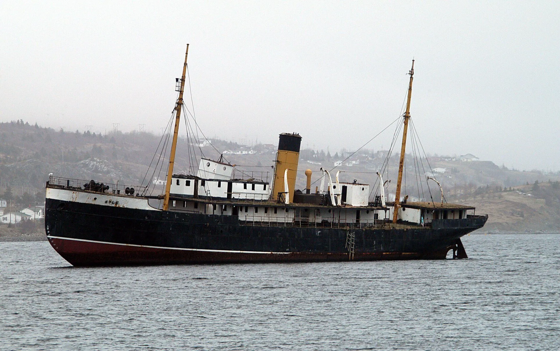
A steel hull sitting in the shallows at Riverhead, aground since February 1967 and never moved. The province's tourism listing calls her the fastest of the Reid Newfoundland Company's Alphabet Fleet and the first regularly scheduled ferry between the island and coastal Labrador; she was launched in 1913. OpenStreetMap records the hull as showing at both high and low tide, so any time of day works.
Stopping here adds about 1.2 km to that drive (96 km start to finish).
Launched in 1913, the SS Kyle was the fastest ship in the Reid Newfoundland Company's Alphabet Fleet, and the tourism board calls her the first regularly scheduled ferry between Newfoundland and coastal Labrador. She ran aground at Riverhead, Harbour Grace, in February 1967 and has stayed there since. The map records her hull as visible at both high and low tide.
Stopping here adds about 1.2 km to that drive (108 km start to finish).
A ship's hull sits aground in the harbour at Harbour Grace, mapped as a wreck and named on the map as the SS Kyle. OpenStreetMap dates the wreck to February 1967 and records the hull as showing above the water at both high and low tide. It is a landmark in a working harbour, not a staffed site.
Stopping here adds about 2.7 km to that drive (132 km start to finish).
Use another map app
Apple Maps · Google Maps · Organic Maps · OsmAnd (both work offline, no tracking) · WazeWhat the map knows
While you're stopped here: Spirit of Harbour Grace (0.3 km away) · Danny Cleary Lookout (1.6 km away) · Gordon G. Pike Railway Heritage Museum (3.8 km away)
From OpenStreetMap, 2026-09-05. Listed, not recommended. How we measure
Access: step-free or not isn't recorded. Ask before you go.
Pin and figures from OpenStreetMap way/572715873 →